Measuring visual quality over time
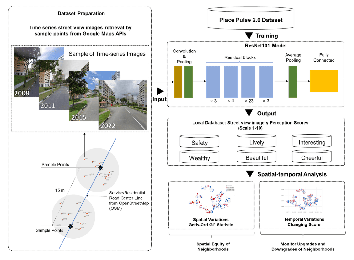
A deep-learning workflow measures six dimensions of visual environmental quality across public-housing neighborhoods in Singapore and New York over a decade.
Research
I develop computational approaches that turn diverse urban data into accountable evidence for planning. My work follows a connected path: first understand what urban data can reveal, then explain how environments shape experience, and finally support decisions that affect people and places.
A connected research program
01 · Selected papers
I turn street-level imagery and other spatial records into interpretable urban evidence, while asking whose environments those data actually represent.

A deep-learning workflow measures six dimensions of visual environmental quality across public-housing neighborhoods in Singapore and New York over a decade.

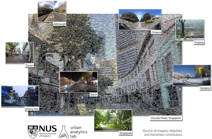
Global Streetscapes provides 10 million crowdsourced street-level images from 688 cities, enriched with geographic, temporal, semantic, and perceptual attributes.

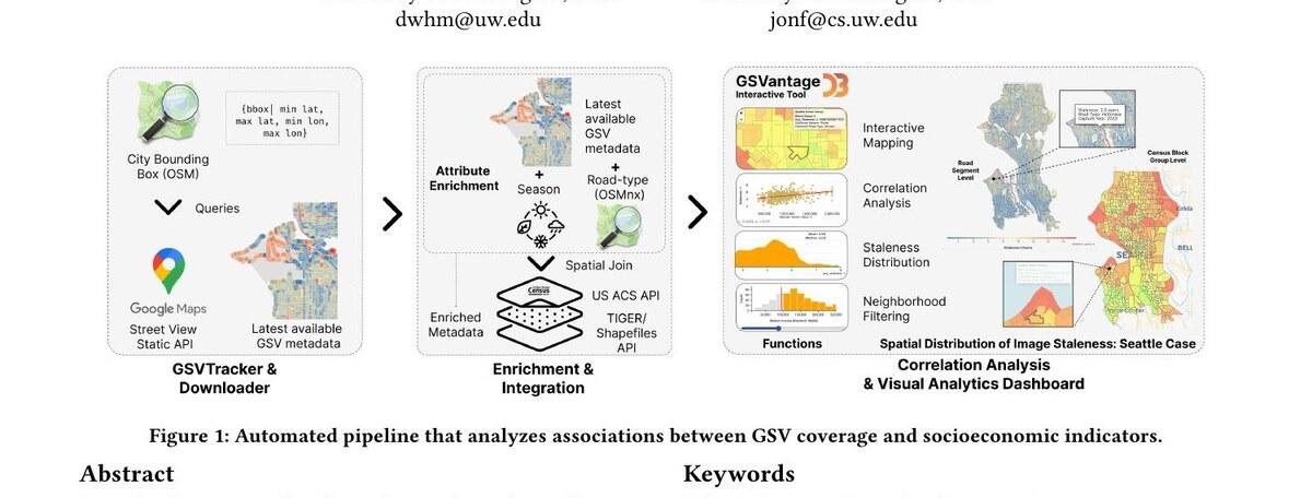
An open workflow evaluates the recency and coverage of Google Street View across four U.S. cities and relates image staleness to neighborhood characteristics.
Additional collaborations
Urban Forestry & Urban Greening · 2024
Combines satellite, street-view, and socioeconomic data to examine how human-scale greenery relates to social vulnerability in Seattle.
ICCV Workshop · 2025
Transforms open government curb-ramp records into large-scale image labels for an accessibility-focused detection pipeline.
ICCV Workshop · 2025
Outlines multimodal AI agents that combine imagery and GIS data to answer practical visual-spatial questions about places and routes.
arXiv · 2024
Uses a hybrid BERT model and spatial analysis to examine public responses to an autonomous ride-hailing service in China.